 I asked Arusha Bikers mailing list about joining me for a short tour. In the end no one could go, so I went alone. Alone is good too.
I had a plan of "finding" this mountain pictured above, called Landanai. It is there on the map, and it is pretty big and all, but maps are pretty sketchy on location of roads , vague, outdated, roads change,etc, so I figured it was still an adventure "finding" it from the north.
Despite starting to get ready Thursday after work it wasn't until 11am on a Friday when I took off. I was tired the night before and started doing maintenance, greasing the front hub, finding some bad bearings.
As I started out I planned to take the old gravel highway east to Usa River and then the tarred road to the Kilamanjaro Airport turn off, then small tracks to Chemka. Due to the late start I decided to keep going east on the highway to Boma Ngombe and then turn south to the Masai steppe, passing the Chemka springs for a swim.
I had an auspicious start through town.
There was no apples in Sakina so I stopped in Kijenge fruit stands for some apples. The guy would only sell me a bag of 8 apples for $3.25. We got talking and he is from Engasumet! Engasaumet is where I hope to reach after Landanai. He confirmed there is a road from the Chemka springs to Landanai. Yes! I was feeling assured that I could easily find a road up the escarpment from Chemka, which was one of the blank stretches on the map in my head and paper.
People were friendly on the gravel road. The occasional vehicle stirred up dust. At Usa Town, as expected, the young guys were bothersome, but a frozen litre of juice tasted pretty good and restored my mood.
At Boma ya Ngombe I needed food and drink. It was hot and I had gone 60km pretty fast.
I made the mistake of asking the traffic cops hassling motorists for a recommendation. They sent me to some place as lazy as traffic cops. Before I parked my bike I asked if there was food they said yes. I carried the 60lbs of bike and baggage up stairs and walked far inside past staring waiters. I sat at a table in a big room for five minutes, watching staff walk back and forth. Finally I yelled at the girl for service. She sauntered over, said sorry she thought I had ordered, and said there was no food ready, but it would only take a few minutes. "Yeah right". I stomped out and back to the highway.
I found a nice , smaller, place right off the road with attentive staff and food ready. No traffic cops eating there. Unfortunately all the veranda tables were taken so I sat inside where there was less breeze. I ate rice and beans and drank coke mixed with water. People cleared out so I had another coke on the veranda and recovered. I talked to someone, but I can't remember if it was waitress or a patron. I need to learn to take pictures in these places. I can't remember what we talked about but I remember it was mellow.
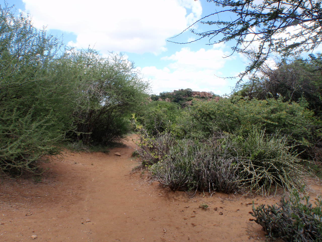
I turned south on a rough gravel road and into a strong wind . I followed another bicycle for awhile. After 20km and an hour later it was late afternoon and I decided to skip the swim as it was late afternoon and I wanted to get out of the populated areas and into the bush . The track through Chemka village got small but everyone knew Kiteto District was "that way".
A vehicle track took me to another unnamed village with a group of wazee (older men) busy doing not much. I was now confronted with a million paths and tracks, the wazee gave me good directions and passing a bridge over a fast flowing river. I took a quick refreshing wash and cycled on. Now I passed through the hills jutting out of the escarpment that marks the springs.
I ask directions from a motorcyclist passing me and he mentions villages to pass through. I only retain Marungu. Luckily I can follow his tracks and as he stopped in every village and I catch him and we leap frog on dusty. Someone is looking out for me. I lose track of him when I turn up the escarpment.
But I get another motorcyclist. This one is Kanunga Mkubwa and he insists I cant sleep out. "you can sleep out and we do if we have to, but my boma is just at the top, so sleep there."
It is too much work to argue. He tells me to ask for him at next village, Lengasti. To this day am still not sure the village name.

This is about half way up the escarpment, looking back to Kilimanjaro massif. It is not steep but continuous slope. I meet Kanunga coming back down again. He says he is going down to pick someone so he might be a bit late but they are expecting me.
I am still trying to figure a way to sleep out in the bush, a way to avoid Kanunga.
I reach the top and find a plateau, kind of a valley with a bunch of buildings out in the middle. It is just before dark but in a few minutes Kanunga comes by with a mama on the back and I follow him down a track through the shops to some block houses.
 This is Kanunga's house and tractor. His house is pretty impressive. I was taken aback, as I was expecting a mud/wattle hut or simple 2 room block house. His brother has similar sized house. We greeted his wives and kids and sat out in the dimming evening and got to know each other. He has some gemstone mines, does some farming, and has the traditional cows and goats.
Bernice, my great supportive wife, had sent me off with some chapatis and sauce for dinner. Kanunga's wife heated them up for me. He ate "chakula ya kawaida" "normal food", which was some left over meat.
There came up a strong wind that he said could get worse, so don't open the window as your room will fill up with sand. I was shown a 4x4 room with a double bed with clean sheets. I figure that is his room.
DAY TWO : Through the basin
I slept well but woke alot. The wind blew 1/2 the night. Kanunga's wife took my UHT milk and made me some chai, and I had some granola. We talked some more , then Kanunga had a business deal to rent his tractor to a charcoal dealer.
Kanunga's directions to Landanai"
"Go around those fields and then veer right (good he told me). follow the road to Mouram, then to that distant mountain Loisoito, there you pass to the left, next is a desolate area that is hot and no people and then before Landania is Lorbene village. Ask directions there."
Directions varied during the day to perfect like this to totally worthless.
 Most of the road was like this. I was feeling great and the bike was running smoothly.
 The road was hard and smooth, occasionally some deep sand.
Mouram is actually a bunch of mines next to the road. What the miners dig up looks like mouram.
 I looked into some mines like this one.
 There is Loisoito 10 km in the distance and I quickly reach there.
I am shy about taking out the camera with people around, too bad, as they are interesting people and lives.
 I talked to a couple of miners and a man herding goats. All the houses in the village were closed up and people out digging in the mines.
I pass through the Loisoto ridge and see this view.
 Because of the dust, sand, brush the road sometimes splintered and came back together. At one point I should of gone left as the right one circled around this basin. I stopped here and took a movie you can watch at the bottom.
Just before Lorbene village I searched out a shady tree and stopped for an hour, about 11am. I took out my sleeping mat and lunched on an apple, snickers, peanut brittle while reading my book. It was pretty hot now.
Lorbene village is a bunch of bomas and shops spread out with confusing roads and people. I probably could of made it to Landanai village on the other side of the mountains if i would of gone west around the mountain in a 2 hours.
Instead I rode through the mtns and got off any road there was..
Here is what happened. The first person I asked was a girl of about 13 who said to take this road going back north. I road north for 5 km and said this cant be right and road back. By that time there was a mama who showed me a path east into the mountains,into the middle. That looked good..

 The trail became a vehicle track.
A young masai told me in English this road went right to Landanai.
 I followed some bike tracks on the road and pretty soon I was on great single track. It was great riding surrounded by craggy mountains. I didn't see anyone for hours. The track got fainter and fainter until it died in a boma (group of huts). However there was the bicycle that made the tracks. The bicycle owner said I was hopelessly lost and missed the track.
I was directed "up to those big baobab trees".
 Soon I was on this "road" that was actually a cattle track but was ride able.
 It was ride able for awhile anyway. The trail started to climb through the mountain and now I was in thick forest. The coolness was appreciated but the riding became more technical.
Root were one thing but long rocky sections was another thing. It meant wrestling and lifting the bike up and over boulders and ledges.
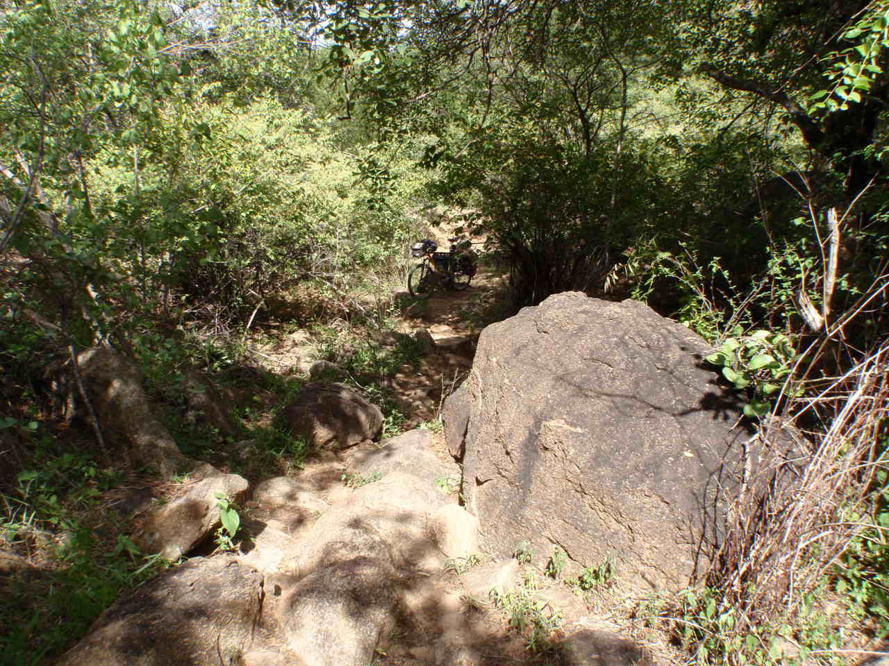 I started to think I was going on a dead end. The path sometimes was over grown.
I was tired and anxious and was not being careful. My cotton shirt caught on a branch and it tore the arm badly, then a few moments the back of the shirt opened up fully. I parked the bike before a rocky place (the bike is in the middle of this picture) and scouted ahead on foot. It got good for awhile and then rocky. I would start to go down and then the trail would find another ridge to go over.
I should of been enjoying the thick forest but I wanted to be "found" instead of slightly lost. I continued on up mostly.

Suddenly I could see the rock face, which meant I had gone around the mountain. There was a big water tank and 3 small kids. They showed me two options down to the water tap.
I found 50 masai women and a few men watering cows.
I was shaky with fatigue and relief and just wanted to cool off. I started to wash in the cattle trough.
A very kind woman decided I needed help. She commandeered a wash basin and filled it with clean water and directed me to go bath in the bushes. It was great bath. I changed shirts. What made me bring two shirts i don't know. I gave the nice woman the rag shirt and she was pretty happy. Then she told one of the girls to fill up my water bag. I gave some kids some ginger snap cookies.
My spare shirt is a Royal Robbins active button down shirt with collar. Royal Robbins was making very good climbing stuff when I was in college and somewhere along the line started making high end "active" clothing. Never could afford his stuff. Anyway the last time in USA Bernice bought a bunch of shirts at goodwill (and a ton of other stuff). I wore this shirt a couple of times and one day in a meeting I was looking at the button (why did i do that?), and was shocked to see it was a Royal Robbins brand. I now noticed it is very comfortable and well cut. The shirt moved from my office shirts to my biking clothes shelf.
Back to my trip.
 The water tank is on the right slope in this picture. I needed to get to the village now for food. I got directions and took off, coasting down a trail I came to a big sand road. Unfortunately I didn't know if village was left or right! I waited a five minutes for someone to happen by. It was quiet so I rode 1/2 way back to the tank and asked which way.
Landanai is a big village spread over 1 km. Alot of mining types and masai all milling around. It is a squalid town with trash , eroded roads, decrepit buildings, and people everywhere. I found a hoteli saying they had food and went around back into the courtyard. The proprietress was lying on a bench and she would direct her waitress to serve me. A miner followed me in to talk. I bought him a soda and had rice and meat and a couple of sodas.
At 5pm I rode out of town. The miner told me 5 km out of town I would see a sign to Naberera, and I should go left. This was my first road sign. Naberera 24km. There were farms here and there but few huts.
 I stopped with plenty of daylight with a view back to my trip destination. Now i would swing south and then west the next day.
 I decided that stopping a bit earlier (instead of dark) would be more relaxing. I strung my hammock, gathered some wood, took a few pictures and then still had time to read of few pages of my novel.
I splurged and took a shower, of sorts. I used 1 litre of water from water bag in a thin stream and rinsed off my body. ahhh, felt great and I wasn't sticky at night.
I didn't cook until about 8pm. only 90km today.
DAY 3 BIG ROADS
 In the morning the camp looks the same. It is not the kind place you would want to sit around in all day, but for a stealth camp it worked. I sit on mwhile cooking over the littlebuy sleep pad while cooking on a little bug wood stove.
I got out of the hammock at 530 and was ready at 645. Then i caught up on the journal until 730 while looking at Landanai and Kilimanjaro mountains.
Some notes here. Yesterday I was scheming about having a styrofoam cooler as beans had gone bad yesterday.
The alcohol for my pepsi can stove must be diluted too much with water, as it takes more to boil 2 cups water and long to start.
In 60 minutes I was in Naberera and I decided on another breakfast. I had 3 cups of milk tea and mandazi. I talked to the owner, a young guy from Kondoa of Mrangi tribe. We talked about his duka, hoteli, hilux pickup, and gemstone dealing. The other people in the shop then started talking trying to figure out why I am riding my bicycle out here.
 East African biking paradise.
 This is for sister Byrna. Have no idea what they are but there was a fair amount of them.
 Man, have roads changed in recent years. I figure I could ride my road bike here.
Road is now really good. Not what I remembered from 20 years ago. Wide , cambered, drainage system, and very smooth. I came accross piles of mourram ready to make it even better.
My pannier has a big rip in it. Remind me to get it sewn.
 Cool looking rock up on Naberera mountain. Naberera mountain is more interesting than Landanai.
 I went through a big korongo that was even labeled as Oljoro. After that the road was like lami. At noon I stopped for over an hour and had the last apple, ginger snaps, snickers, and water.
I thought about how I could lighten my load. Wear sandals, less snacks and buy along the way, the padded chair thing is nice but i could live without, only one pot, buy cooked rice in the evening and carry to camp, smaller or no leatherman, handle bar bag is heavy, no lock or a lighter one, less tools? and spares?
Routine. Start earlier, ride 6 to 10am and find a chai shop. 1030 to 1pm and then under a tree for 2 hours. 3-6 ride. write in the evening. Nice to break under the tree mid day.
It has been remarkable how few vehicles and walkers I am meeting outside of the villages after Naberera.
For some reason I did not touch the peanut butter, honey, or fruit/nut mix during this trip.
 I see more game.
 Not sure why I uploaded this picture.
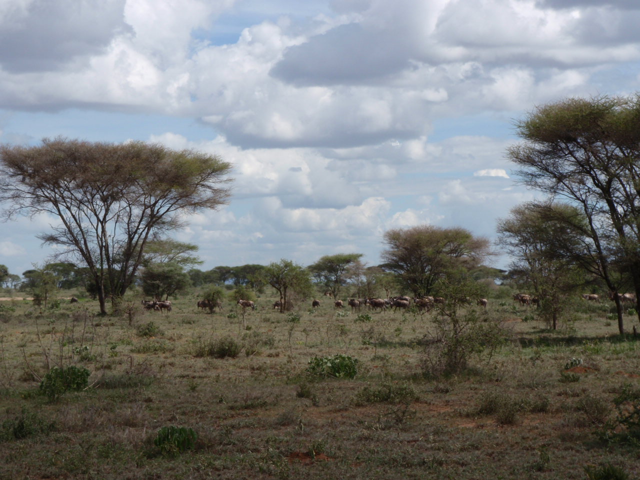 More zebra. Ho hum.
I was a bit tired but went on to Terat for dinner. There is no alternative anyway. I saw the Loiborsoit road but went the 5km to Terat and had some rice & beans, water and cokes.
After backtracking I was on a track and was seeing more wildebeest zebra and gazelle.
There is a shallow korongo and you branch right for Lolkisale and loiborsoit.
 I am on a track now, unimproved and heading towards rain clouds.
I am through the plains and into forest again.
Sped through Loiborsoit. It was getting late and I waited until I hadn't seen a field for 1 km, then road 500m off the road. I was thinking i would not be noticed but as I was setting up a masai comes walking by. He said there were bomas all around and later at night as it got still i could hear them. I cooked up some Ramen and soup.
100km.
Day Four
I got out of the bed at 510 and a cow ran through my camp. The wood stove works great if you put in sticks slowly.
 Lovely campsite.
It was cool and almost going to rain for the final section to Lolkisale.
 I stopped here and was told tea and chapatis were almost ready. I waited 30 minutes as the day warmed up.
I didnt feel like eating chapati but I did. As the clouds burned away I put on sunscream, bought 3 litres water, and more chapati.
The road is hard, smooth, and downhill off of Lolkisale mountains. I missed the "short cut" as I was going so fast I didnt feel like stopping often to ask.
It sprinkled a bit making riding even better. At the bottom the sun came out and I slogged up the other side.. The rivers had water and one was actually running. I put some dirty water in a bottle for pouring on my head. I stopped stopping now and by 10km to home my foot was hurting so I had to stop in burka and deal with that. i rode 90km
What i would do differently.
Better maps.
Plan water better and carry less.
Try to carry less food and buy more mid day for evening.
Less weight.
wide brimmed hat for shade all sides
cotton shirt.
sandals
check conditions of panniers
If just me less spares.
more suncream
3 water bottles and 2 3 litre bags.
camp seat was nice
book was nice
apples nice
more granola
One pair shorts
one clean shirt
Going alone was good. Always ask directions 2-3 times.